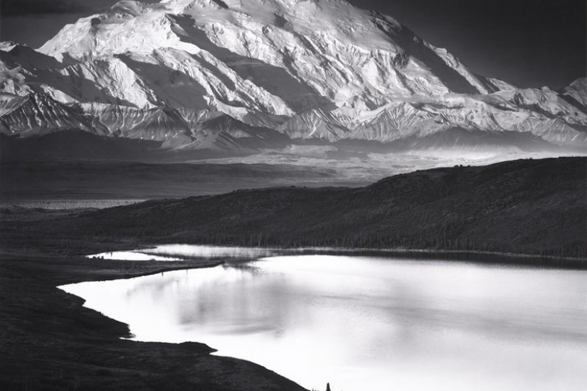
When it came to Denali and Wonder Lake, no one could even agree on the year: Olson found interviews, autobiographies, collections, and studies that claimed the photo was taken in 1947, and folios, letters, and exhibition catalogs that said 1948 instead.
But as Olson’s team has found previously, the sky itself is a peerless record. In the past, the team had used the moon’s shape and position to figure out exactly when and where another famous Adams photo, Autumn Moon, was taken. While Denali and Wonder Lake lacks any celestial objects to hang an investigation on, Moon and Denali, below, features a waxing gibbous moon glowing through the clouds.
“We realized that we could use the lunar phase and position of the sky of Moon and Denali to calculate the date of that evening scene,” Olson writes. A look at field notes from Adams, as well as from his son and travel companion, Michael, revealed that Denali and Wonder Lake had been taken the next morning.
To determine these two “whens,” they first had to figure out each “where”: the exact location of Adams’s tripod when he released the shutter. The rippled landscape of Moon and Denali provided clues. “The foreground of [the photograph] includes geological features known as ‘cirques,’ semi-circular steep-sided hollows shaped like amphitheaters,” Olson writes.
“If the image has foreground objects that we can see aligned with distant background objects, then we can use the alignments to figure out exactly where the artist was located,” Olson says, in an email. So he and a student, Ava Pope, got some detailed topographic maps of Denali National Park. By comparing the shapes of the cirques in the photograph with the contours on the maps, they were able to identify the locations of several landmarks in the photograph, and measure how far they were from each other.
Using this information, he writes “we wrote a computer program that could calculate the view from any possible spot for Ansel Adams’s tripod,” correcting for refraction and the Earth’s curvature. “Our computer program eventually produced a camera position where the calculated view appeared to match the photograph.” They then called up their man on the ground, Jon Paynter, a GIS specialist who works at the park.
